| Shelton Land Conservation Trust, Inc. |
| Shelton Land Conservation Trust, Inc. |
|
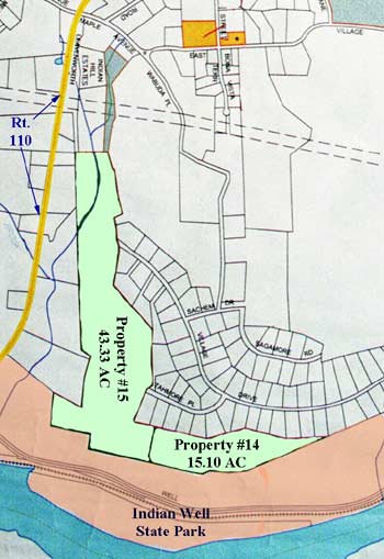
Map
Description
| ||
| SHELTON LAND CONSERVATION TRUST, INC. |
Shelton Land ConservationTrust, Inc. is a member of The Electronic Valley
Web hosting supplied by The ElectronicValley